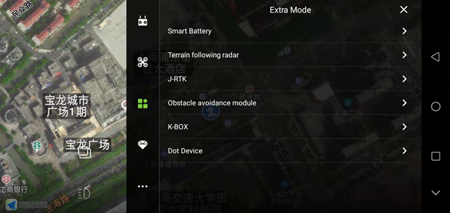
Expansion module interface
The expansion module interface includes: smart battery, ground simulation module, J-RTK, obstacle avoidance model fast, K-BOX, and dotter.
1. Smart battery
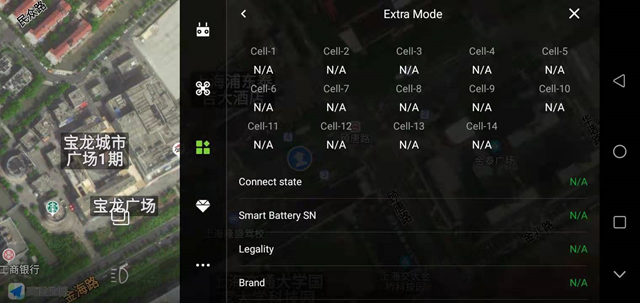
You can view the information and usage of the smart battery
2. Imitation ground module
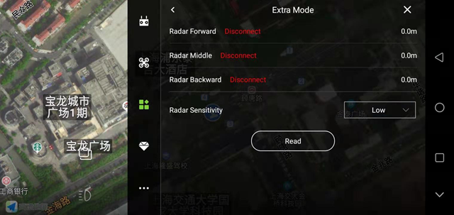
It can support the front, middle and back three simulation grounds, which can be used directly by plugging in CANHUb;
Low sensitivity: Suitable for high-stalk crops (such as sorghum, corn, etc.), imitating the ground smoothly, and restricting the descending speed. It can prevent falling and twitching caused by the lodging of the high pole and the uneven high pole.
Medium sensitivity: Suitable for most scenes and non-high-stem crops (such as rice, wheat, soybeans, etc.). The speed of imitating the ground is moderate, and the response is moderate.
High sensitivity: It is suitable for demonstration effects and some non-operating entertainment occasions. It is sensitive to ground imitation, rises quickly, and falls quickly.
3. J-RTK
Connection status: display RTK connection status;
Fixed heading: display the RTK heading status, dual-antenna RTK will appear fixed, single-antenna RTK does not;
Differential delay: RTK differential data generally jumps between 1-3, which means that the RTK signal is in good condition;
Expiration time: The expiration time of the RTK fee. Generally, it will be automatically extended for one year after activation;
Activation status: The mobile phone turns on the network and connects to the airplane. It will show whether the RTK is activated or not;
RTK SN: After connecting to the plane, you can check the RTK SN number. If the RTK fee has expired, you can click “Recharge” here and follow the steps (to recharge first to communicate with the sales)
Recharge: After clicking “Recharge”, you can recharge the device (when the usage time has expired)
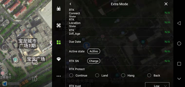
RTK failure protection: protection behavior triggered after RTK failure, protection behavior includes: continue, land, hover and return; generally set to continue;
RTK trust level: high, medium, low; generally set to medium when RTK is installed;
High: RTK positioning and fixed heading can be unlocked for takeoff;
Medium: RTK positioning and the RTK heading is consistent with the heading of the magnetic compass, you can unlock the takeoff;
Low: GPS positioning can be unlocked;
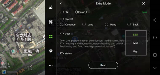
RTK link: When using the mobile phone network for signal transmission, there will be data bounce (increasing) here;
4. Obstacle avoidance module
It can support front and rear obstacle avoidance radar modules or use multi-point obstacle avoidance radar. When you want to use the bypass function, it is recommended to use a multi-point obstacle avoidance radar;
Obstacle avoidance enhancement: After turning on the switch, the triggering rate of obstacle avoidance behavior will be increased;
Operation mode automatically turns on obstacle avoidance: After turning on the switch, the obstacle avoidance radar will automatically turn on when performing AB point operations or fully autonomous operations;
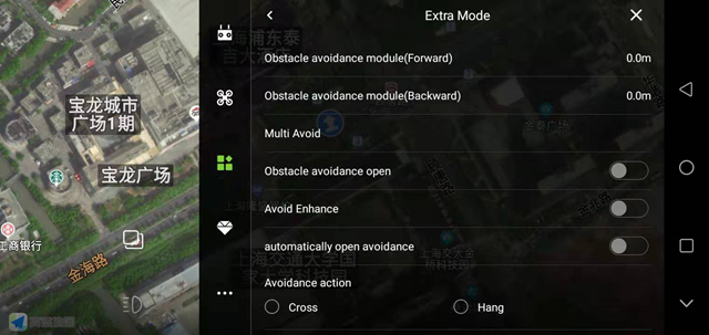
Obstacle avoidance behavior: detour and hover;
Hovering: The aircraft will trigger the hovering behavior after an obstacle is detected during the flight;
Obstacle circumvention: When the aircraft detects an obstacle during the flight, the aircraft will perform the behavior of circumventing the obstacle;
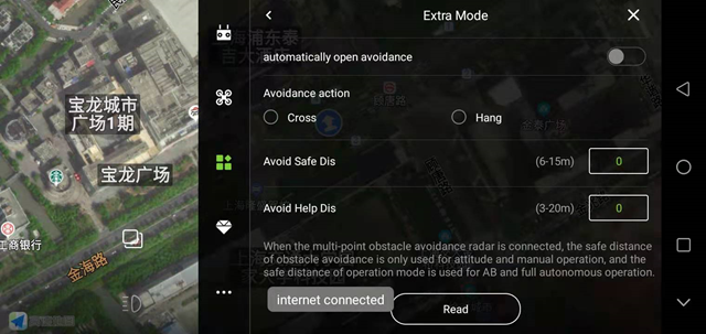
Obstacle avoidance safety distance: After the aircraft detects the obstacle, the distance between the final hovering position of the aircraft and the obstacle (generally set 8-10 meters);
Auxiliary advance distance: After the aircraft moves laterally, the actual advance distance = banner + auxiliary advance distance = 2 * obstacle avoidance safety distance + obstacle diameter;
5. K-BOX
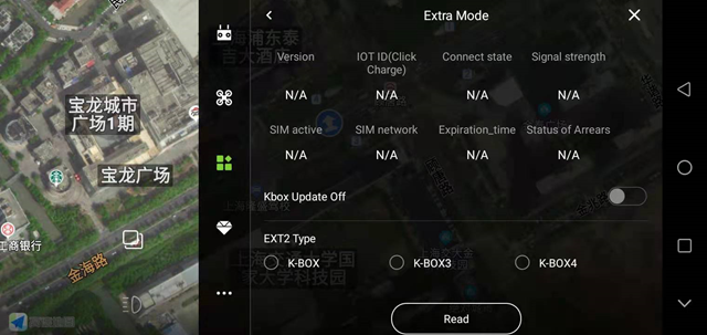
There are currently three KBOX products: K-BOX, K-BOX3, and K-BOX4. After clicking Read, select the suitable device type, and click Save. After the aircraft is powered on again, you can view the KBOX data information;
6. Coordinate collector
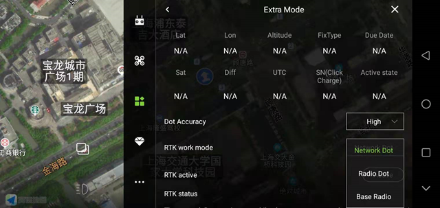
After using Bluetooth to connect to the RTK inker, you can view the RTK data information on this interface; first check whether the RTK is activated, if not, then the “Activate” button behind the motor;
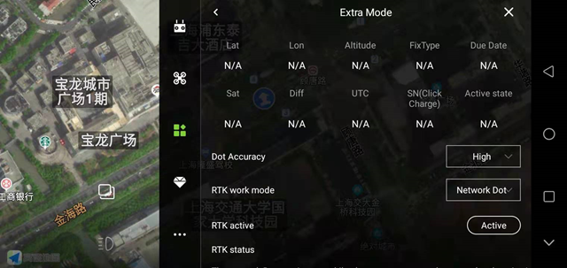
Stacking, longitude, height: Display the real -time latitude and longitude high data of the RTK scaler;
Solution status: 4 when normal use; when displayed 1 or 2, you cannot step on the point; when displayed 5, you can use low precision to step on the point;
Understanding time: The radio can be used all the time, the network scorer will have time limit, and recharge after expiration;
Number of satellites: Display the real -time satellite received by the RTK doter;
Differential: Normal display at 1-3, the larger the value, the worse the accuracy;
SN number: Show the SN number of the RTK scorer (unique code);
Accuracy: high accuracy and low accuracy. Generally, high precision is used for stepping, if high precision cannot be used for stepping, low precision can be selected for stepping;
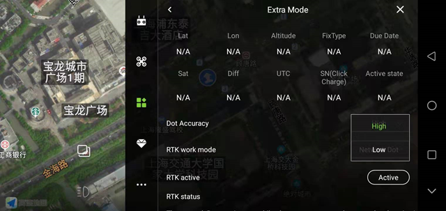
RTK working mode: network version, radio version and base station.
Online version: The default RTK RBI is the online version. The online version of RTK is generally used in China;
Radio version: generally used in conjunction with the base station, when using the inker abroad, when the base station is assumed, the inker needs to select the radio version, and then you can step on it;
Base station: In addition to the traditional base station, the all-rounder can also be used as a base station. Set it here;
