Airline flight
Add route
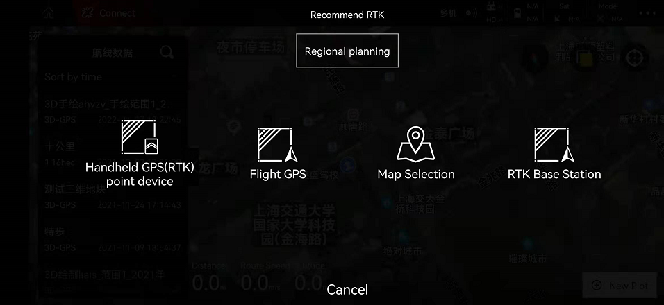
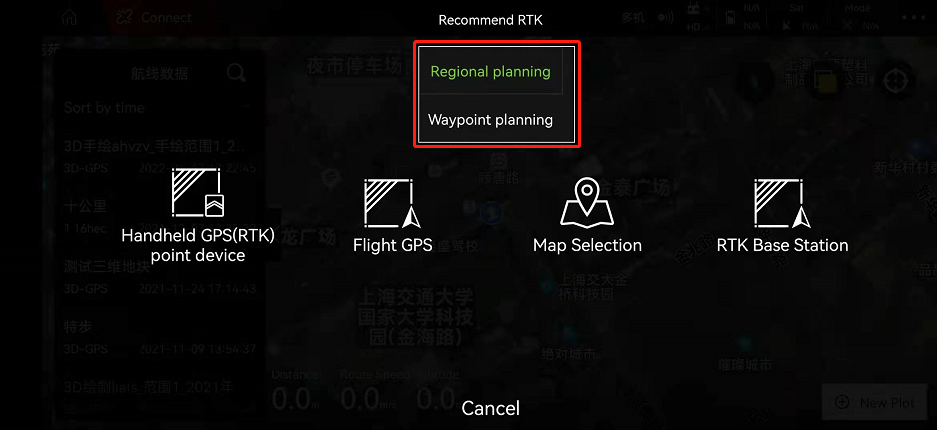
There are three ways to add waypoints: handheld GPS (RTK) markers, aircraft GPS and map point selection.
Hand-held GPS (RTK) pointer: high precision and easy to do. People need to reach the corresponding place and step on the points one by one.
Aircraft GPS: High precision, need to fly to the corresponding place to step on.
Map point selection: low accuracy, use the map to step on the corresponding point.
1. Add waypoint
There are two types of waypoints added
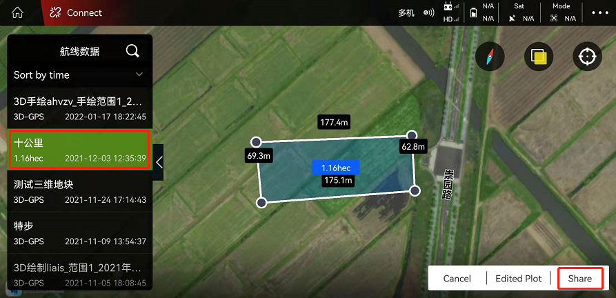
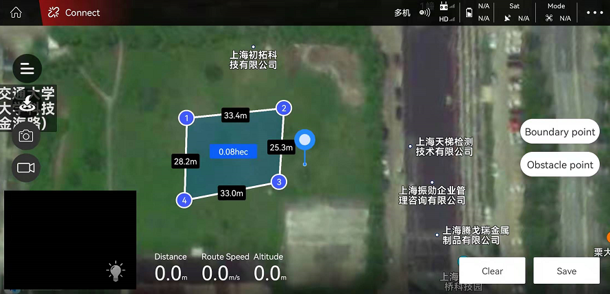
1). Regional planning: Carry out the stepping points on the regional terrain (polygonal area), and the plot belongs to the two-dimensional terrain;
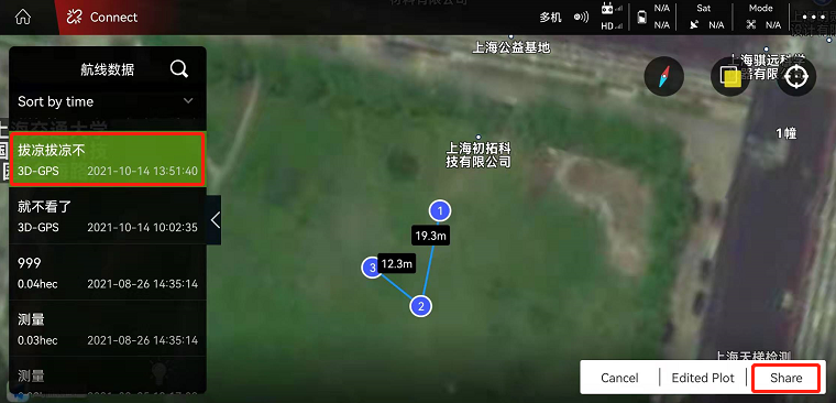
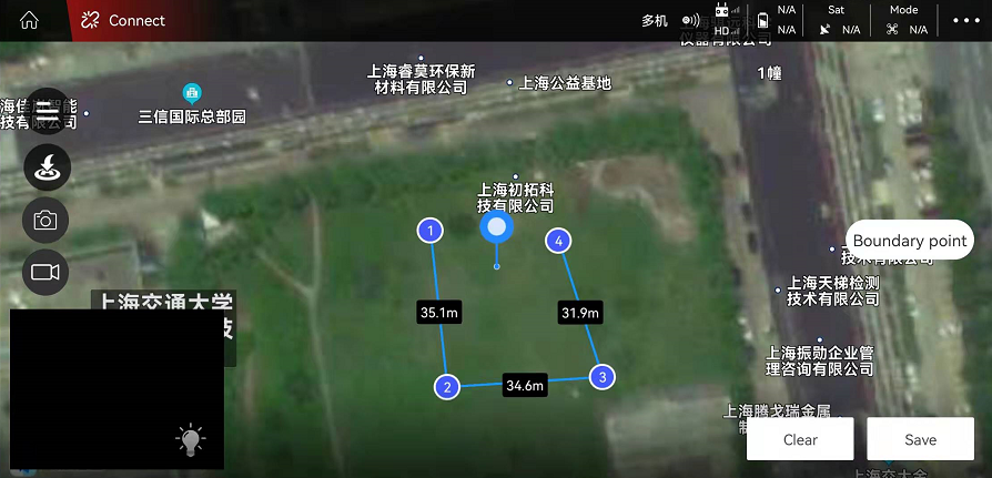
2) Waypoint planning: single-point step-on-point, multiple single points are connected to form a route. The collected points are three-dimensional waypoints (the height can be set).
1.1. Regional planning
Take the point selection on the map as an example. Move the cursor to the corresponding position and click “Boundary Point”. After adding the waypoint, click “Save”. The planned route can be found in “My Land”.
1.2. waypoint planning
Take the point selection on the map as an example. Move the cursor to the corresponding position and click “Boundary Point”. After adding the waypoint, click “Save”. The planned route can be found in “My Land”.
Edit height
Find the added route in “My Land”. Click on “Edit Plot” in the lower right corner, click on a point (select 2 points as shown in the figure), and a dialog box will appear on the right. As shown below:
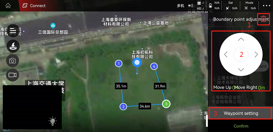
1. Delete waypoint: After clicking, you can delete unnecessary waypoints;
2. Adjust the position of the route: you can fine-tune the position of the waypoint;
3. Waypoint setting: After clicking, the attributes of the waypoint can be set. As shown below:
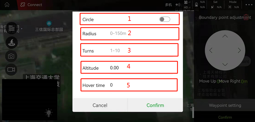
Note:
1). Whether to make a circle: the default is no circle, after turning on the switch, you can set the circle attribute;
2). Circle radius: you can set the radius of the airplane flying around the waypoint;
3). Circle circle book: You can set the number of circles the aircraft flies around the waypoint;
4). Waypoint altitude: the altitude of the plane flying at this waypoint can be set.
5). Hovering time: You can set how many seconds to stay at the waypoint.
After setting the waypoint properties, click “Save”. Select “Overwrite the original plot” or “Save a new plot as”
2 Assignment of tasks
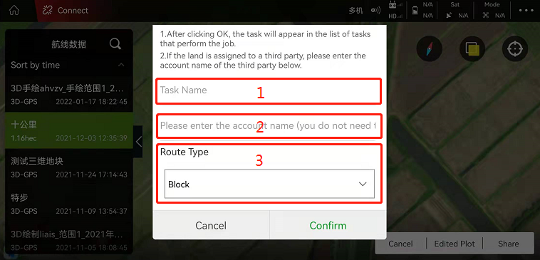
Find the planned plot in My Plot, and after selecting it, click Task Assignment (area planning is the same as waypoint planning). As shown below:
